


The Border in Pomerania in the International Political Game of the 20th Century
The shifting of Poland’s borders far to the west, and along with it, the division of Pomerania by a state border, was among the most significant and unexpected geopolitical consequences of World War II. Even before 1939, there was little indication that West Pomerania, and particularly Szczecin (Stettin) and the mouth of the Oder River, would come to be within the borders of the Republic of Poland.
Szczecin (Stettin) remained deep inside German territory. It was separated from the Polish border by approximately 120 kilometers, and its ties to the reborn Polish state were very limited. Admittedly, around 40,000 Poles—mostly seasonal workers—had settled in West Pomerania in the 19th century; however, during the interwar period, this number systematically declined. Just before the war, about 500 people declaring Polish nationality lived in Szczecin itself. In a city of nearly 384,000 inhabitants, this was a group devoid of any significant demographic or political importance.
Admittedly, the Polish community endeavored to maintain its identity. Local structures of the Union of Poles in Germany were active, a Cub Scout and Boy Scout troop was organized, and Polish language instruction was conducted. However, these were initiatives typical of minority environments, having no real impact on the political situation of the region. Nevertheless, in the circles of Polish Western Thought (polska myśl zachodnia), particularly those associated with the Greater Poland (Wielkopolska) region, interest in the mouth of the Oder River remained vibrant; yet, before September 1939, these demands were primarily programmatic in nature. In the realities of that time, it was difficult to see any genuine prospects for their realization.
The War and the First Questions About the New Map of Europe
Radykalną zmianę przyniosła agresja Niemiec na Polskę we wrześniu 1939 roku. Już od pierwszych dni wojny stawało się jasne, że jej zakończenie wymusi głęboką przebudowę mapy Europy. Dotychczasowy porządek załamał się, a wraz z nim pojawiła się potrzeba nowego uregulowania sporów terytorialnych. Gdy jesienią 1939 roku brytyjscy i francuscy politycy rozważali przyszły kształt kontynentu, nie kierowali się polskimi prawami historycznymi. Dostrzegali jednak, że dotychczasowa granica polsko-niemiecka była niestabilna i nie dawała Europie poczucia bezpieczeństwa. Powszechnie godzono się z jej korektą na rzecz Polski.
From the Polish point of view, the matter looked somewhat different. The fundamental assumption of nearly all political circles remained the preservation of the pre-war eastern border. This applied both to the government of the Republic of Poland in exile, operating first in France and subsequently in Great Britain, as well as to most political groupings, both in emigration and within the home country. Regardless of programmatic differences, there was consensus that Poland could not lose the lands occupied by the Soviet Union after 17 September 1939. All deliberations concerning the western border were subordinate to this assumption.
Dlatego początkowe polskie postulaty terytorialne na zachodzie miały umiarkowany zakres. Obejmowały przede wszystkim włączenie do Polski Wolnego Miasta Gdańska, całych Prus Wschodnich, wraz z dzisiejszym obwodem kaliningradzkim, oraz Górnego Śląska. Były to żądania uznawane zarazem za ambitne i realistyczne. Już w grudniu 1939 roku rząd RP mówił o ograniczeniu niemieckiego panowania nad Bałtykiem i znacznym rozszerzeniu polskiego dostępu do morza, lecz nawet najbardziej optymistyczne warianty nie przewidywały jeszcze granicy na Odrze i Nysie Łużyckiej.
The situation was complicated by the year 1941. Following the German attack on the Soviet Union, Moscow joined the anti-Hitler coalition. Apprehension emerged within Polish political circles that the Western Allies might treat the Polish eastern lands as the price for keeping the USSR in the war against Germany. The second problem was the Atlantic Charter, proclaimed in August 1941, which invoked the principle of national self-determination. It was difficult to expect that the German inhabitants of West Pomerania, Lower Silesia, or Szczecin (Stettin) would declare themselves in favor of annexation to Poland.
Between the Kresy and the Oder
Powściągliwość polskiego rządu wynikała przede wszystkim z obawy o los ziem wschodnich. Przed wojną Polska zajmowała około 389 tysięcy kilometrów kwadratowych. Po agresji Związku Radzieckiego na jego rzecz utraciła blisko 200 tysięcy kilometrów kwadratowych, a więc ponad połowę terytorium. W polskiej polityce panowało przekonanie, że wysuwanie daleko idących żądań na zachodzie mogłoby ułatwić aliantom zgodę na oddanie ZSRR Wilna, Lwowa i innych ziem wschodnich. Właśnie dlatego przez kilka pierwszych lat wojny Szczecin i Pomorze Zachodnie prawie nie pojawiały się w oficjalnych planach granicznych.
Istniała także bariera demograficzna. Na obszarach, które po wojnie znalazły się w granicach Polski, mieszkało przed 1939 rokiem od 8 do 10 milionów Niemców. Już w pierwszych miesiącach wojny w kręgach alianckich dopuszczano możliwość ich powojennego przesiedlenia, ale rodziło to zasadnicze pytanie: kto miałby zająć miejsce milionów wysiedlonych mieszkańców? Zakładano, że w razie odzyskania Kresów Polska będzie dysponowała ograniczonym potencjałem osadniczym. Na znacznej części ziem wschodnich ludność polska stanowiła mniejszość. Trudno było więc wyobrazić sobie jednoczesne utrzymanie przedwojennego terytorium i zasiedlenie rozległych obszarów zachodnich.
Pomerania in the Programs of Polish Political Circles
Ostrożność oficjalnej polityki nie oznaczała, że w polskich środowiskach eksperckich nie dostrzegano znaczenia Pomorza Zachodniego. Już jesienią 1939 roku w jednym z wewnętrznych opracowań Oddziału III Sztabu Naczelnego Wodza pojawiła się teza, że bezpieczeństwo Polski wymaga oparcia granicy zachodniej o dolną Odrę. Autorzy wskazywali, że granica powinna przebiegać wzdłuż wschodniego brzegu Zalewu Szczecińskiego, a Szczecin powinien znaleźć się po stronie polskiej. Miasto i ujście Odry zaczynano postrzegać jako strategiczną bramę do wnętrza kraju.
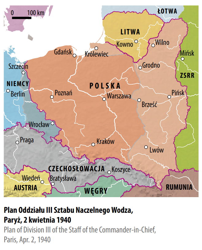
Podobne wnioski formułowała Międzyministerialna Komisja do Spraw Niemieckich. Już po rozpoczęciu wojny niemiecko-radzieckiej i ogłoszeniu Karty Atlantyckiej postulowała przesunięcie Polski do ujścia Odry, ze Szczecinem, Świnoujściem, Zalewem Szczecińskim, Wolinem i Uznamem po stronie polskiej. Zbliżone stanowiska pojawiały się w opracowaniach Polskiego Państwa Podziemnego. Delegatura Rządu na Kraj w nieoficjalnych analizach rozważała nawet przyłączenie ziem sięgających dalej na zachód od Szczecina, choć w deklaracji z 15 marca 1944 roku ograniczyła się do ostrożniejszej formuły „klina pomorskiego” między Odrą, ujściem Odry a Notecią. Jednocześnie podkreślała konieczność trwałego zabezpieczenia polskich interesów gospodarczych na całej Odrze i w portach nadodrzańskich.
Jeszcze śmielsze projekty formułowały środowiska polskiej myśli zachodniej, działające głównie w Wielkopolsce. Organizacja „Ojczyzna” domagała się przyłączenia Pomorza Zachodniego ze Szczecinem, ujścia Odry oraz Śląska z Wrocławiem, uzasadniając to względami moralnymi, strategicznymi i gospodarczymi. Dalej szły grupa „Szaniec” i Konfederacja Narodu, w których programach pojawiały się koncepcje granicy przesuniętej miejscami kilkadziesiąt kilometrów na zachód od Odry i Nysy Łużyckiej, a nawet postulaty objęcia przez Polskę Rugii oraz całej Zatoki Pomorskiej. Wszystkie te koncepcje łączyło przekonanie, że bez kontroli dolnej Odry i zachodniopomorskich portów trudno będzie zapewnić Polsce bezpieczeństwo i trwały rozwój gospodarczy.
In the historiography of the Polish People’s Republic, it was strongly emphasized that the annexation of the western and northern territories was primarily the achievement of the communists. The reality was more complex. Until the summer of 1944, the position of communist circles regarding the future western border remained restrained. The starting point was the principle of incorporating lands considered historically Polish, including areas germanized after the partitions. On this basis, however, it was difficult to justify the inclusion of West Pomerania along with Szczecin (Stettin), which did not belong to the lands seized from the Republic of Poland in the 18th century.
Even the PKWN Manifesto contained only general declarations about ‘ancient Polish Pomerania,’ ‘Polish Silesia,’ ‘East Prussia,’ ‘broad access to the sea,’ and ‘Polish boundary posts on the Oder.’ Such formulations could be interpreted in various ways. The reason was obvious: decisions concerning borders remained in the hands of Joseph Stalin, and the Polish communists did not pursue an independent policy in this matter.
This is confirmed by a secret agreement signed on 27 July 1944 between the PKWN and the government of the Soviet Union. In it, the PKWN recognized the eastern border based on the Curzon Line, and in return, the USSR declared its support for Polish claims in the west, reaching the Oder and Lusatian Neisse rivers. The agreement was asymmetrical: the Polish side agreed to the loss of vast areas in the east, whereas the Soviet commitment concerned merely supporting Polish demands regarding the future western border. In line with this position, however, from September 1944, communist propaganda began to showcase the acquisition of Szczecin (Stettin), the mouth of the Oder, and the lands up to the Oder and Lusatian Neisse as the foundation of its program. This was a fundamental change of tone: slogans that had previously appeared cautiously or in internal documents became an element of the official legitimization of the new authority.
Decisions of the Great Powers
Ultimately, it was not Polish decisions, but the interests of the Great Powers that determined the shape of the border. Paradoxically, one of the first politicians to speak of the possibility of incorporating Szczecin (Stettin) into Poland was Joseph Stalin. The subject emerged during talks conducted in Moscow by Prime Minister Władysław Sikorski in December 1941. For the Soviet leader, Poland’s western territorial acquisitions could become an argument reinforcing a future government dependent on Moscow. Since he considered the fate of Poland to be predetermined, it seemed more advantageous to him to locate an important port on the Oder within a state subordinated to the Kremlin rather than in Germany, whose post-war future was less certain.
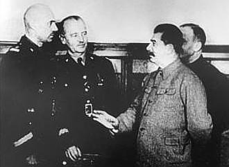
Nieoficjalnie znaczenie ujścia Odry dostrzegali również niektórzy polscy politycy. Generał Sikorski sondował tę sprawę w rozmowach z Franklinem D. Rooseveltem, a po jego śmierci podobne działania podejmował Stanisław Mikołajczyk. Nadal jednak były to rozważania dalekie od oficjalnego programu rządu.
A breakthrough was brought about by the years 1943–1944. The victories at Stalingrad and in the Battle of Kursk gave the Soviet Union the strategic initiative on the Eastern Front, and during the Tehran Conference, the leaders of the Great Powers agreed that Poland’s eastern border would be delineated approximately by the Curzon Line. Polish representatives did not participate in these determinations and, for a long time, remained unaware of their true significance.
Mikołajczyk continued to count on the support of the United States and Great Britain. In June 1944, during a visit to Washington, he heard declarations from Roosevelt suggesting that the United States would not agree to territorial changes made by force during the war. In hindsight, however, it is clear that these words also had an electoral dimension: the president was seeking a fourth term and was soliciting the votes of American citizens of Polish descent. Yet Mikołajczyk’s visit to Moscow in October 1944 dispelled the Polish prime minister’s illusions. When Vyacheslav Molotov stated that the matter of the eastern border had already been resolved in Tehran, and Winston Churchill and Anthony Eden, who were present at the meeting, did not protest, it became clear that the West did not intend to challenge Soviet claims.
The disclosure of these facts caused key Polish leaders to rapidly re-evaluate their point of view regarding the borders. Since retaining the Kresy was proving impossible, more and more politicians recognized that Poland should demand the broadest possible compensation in the west. A special place in this program was occupied by West Pomerania, Szczecin (Stettin), and the mouth of the Oder. Signals favoring such solutions also began to emerge from British diplomatic circles. Incorporating the mouth of the Oder into Poland was considered there as one of the variants of the post-war order.
Yalta and the Birth of the Polish Consensus
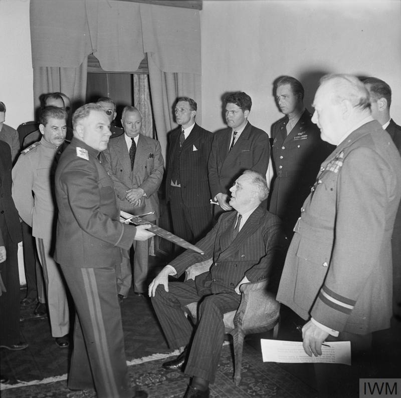
In February 1945, the future of Poland became one of the topics of the Yalta Conference. Neither the Soviet Union nor the Western Allies deemed it necessary to consult border plans with the Polish government. Just before Yalta, representatives of the United States and Great Britain met in Malta, where they considered a limited shift of Poland to the west to be most appropriate. In the maximalist variant, they were inclined to accept a border based on the Oder, but without Szczecin (Stettin) and without Wrocław (Breslau). This stemmed from a rather literal treatment of the river as a natural border: since Szczecin lay on the western side of the Oder, in the eyes of Western politicians, it easily became an argument against Polish claims. They treated the concept of a border along the Oder and Lusatian Neisse, encompassing both cities, as too far-reaching.
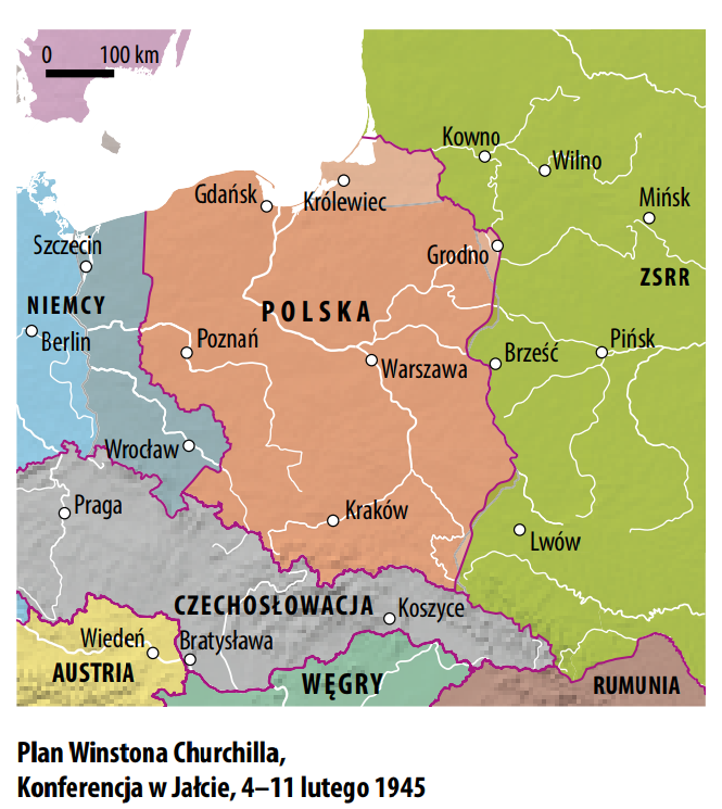
Stalin proved to be more favorable to the Polish demands. However, due to the divergence of the Allies’ positions, the official Yalta communique did not specify the exact course of the future western border. It merely stated that Poland should obtain ‘substantial accessions of territory in the north and west.’ It was understood that this would encompass Gdańsk (Danzig), a part of East Prussia, and a part of Upper Silesia. Conversely, the eastern border left no room for doubt: the Allies accepted its course along the Curzon Line.
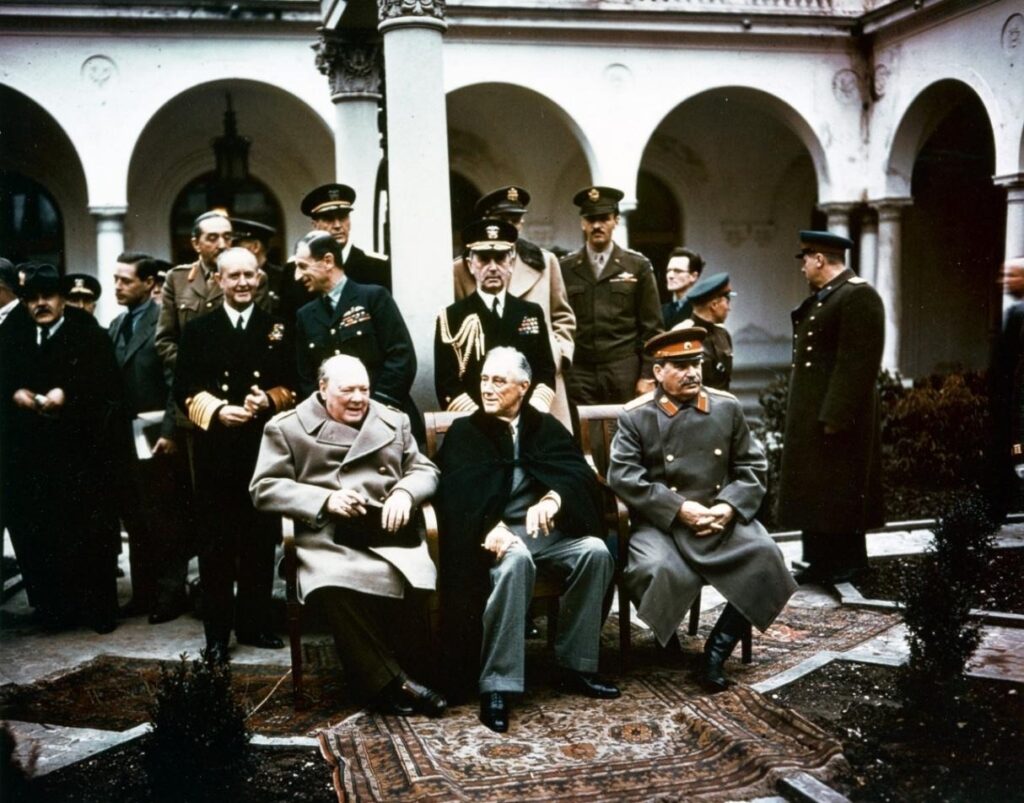
Following Yalta, it became clear that the battle for Vilnius and Lviv had been lost. In this situation, the issue of compensation in the west took on a new significance. From the spring of 1945, one can speak of a broad Polish consensus regarding the border along the Oder and Lusatian Neisse rivers, as well as the inclusion of Szczecin (Stettin) and Wrocław (Breslau) into Poland. This applied to the communists supported by Moscow, the groupings forming the Polish Underground State, and a significant part of the emigration. A divergent position was essentially presented only by the new émigré government of Tomasz Arciszewski, which was, however, devoid of any real influence on the course of events.
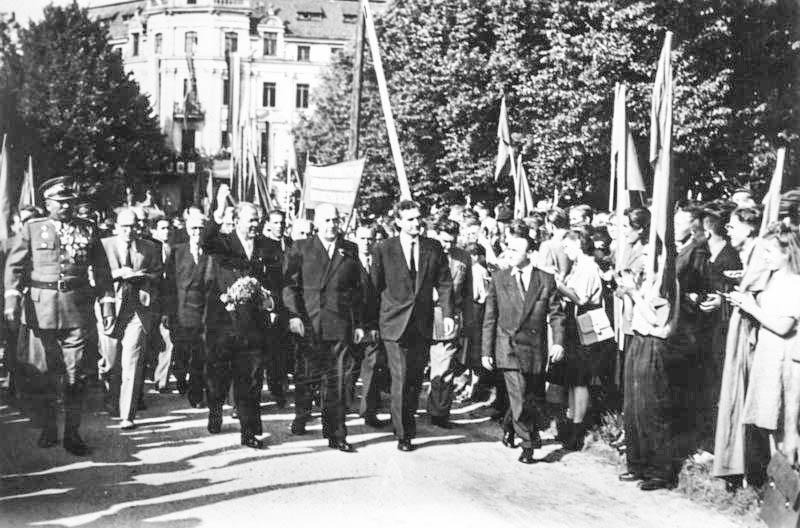
Stalin, however, did not wait for further agreements. On 20 February 1945, the State Defense Committee under his leadership adopted the assumption that Poland’s western border would run along the Oder and Lusatian Neisse rivers, and that Szczecin (Stettin) would be on the Polish side. From that moment on, the Polish administration appeared in the western territories, and this occurred even before the Potsdam Conference. A unique role was played by Szczecin, where the authorities, headed by President Piotr Zaremba, were established at the end of April, subsequently had to leave the city twice, and finally took it over on 5 July 1945. The symbolic dates of seizing power in western cities thus preceded the Potsdam decisions. This demonstrated that the Soviet side and the Polish administration subordinated to it were acting by a method of accomplished facts.
Poczdam
The Potsdam Conference, which met from 17 July to 2 August 1945, was of crucial importance for the course of the Polish-German border. However, it was not a peace conference. Its participants were creating the framework for the functioning of post-war Europe, rather than a final treaty with Germany. One of the most important issues was the borders and the associated mass displacements of the German population.
Poland’s starting point was difficult. In the east, the loss of the Kresy was already predetermined, while in the west, a legally recognized border did not yet exist. The Western Allies still viewed the transfer of Szczecin (Stettin), the mouth of the Oder, and the entirety of Lower Silesia to Poland with reservation. At the same time, it was precisely then that the earlier demographic and economic problems began to form a new logic. The loss of the Kresy meant the displacement of millions of Poles who could resettle the western territories. Meanwhile, control over the mouth of the Oder was becoming a prerequisite for the economic utilization of Pomerania, Silesia, and the entire new territorial arrangement of the state. Szczecin was thus not merely a seaport, but the natural culmination of an economic artery linking the Baltic Sea with its industrial hinterland.
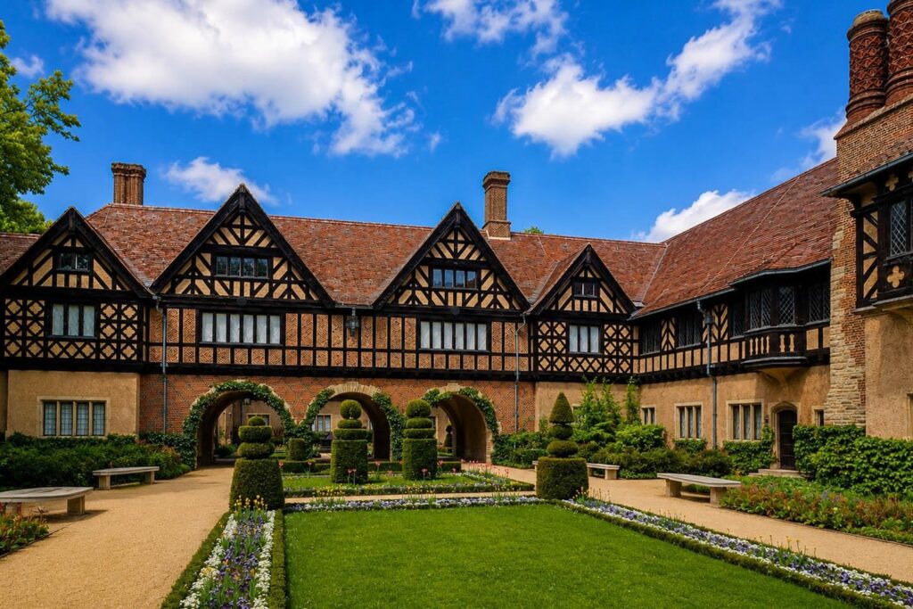
Poland was present in Potsdam, although not with the rights of a great power. The delegation included Bolesław Bierut and Stanisław Mikołajczyk, who represented vastly different political circles. Despite profound differences, both presented a position on the western border that was fundamentally identical. For the Western Allies, this came as a surprise. A dispute had been expected; instead, regarding the issue of West Pomerania, Szczecin (Stettin), Wrocław (Breslau), and the border along the Oder and Lusatian Neisse, Polish unity prevailed.
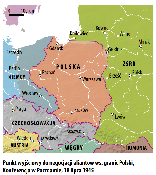
Discussions continued almost until the very end of the proceedings. Initially, Churchill and Truman were inclined to accept the transfer of West Pomerania to Poland, but without Szczecin (Stettin). As late as 29 July 1945, the drafts did not include all the areas that ultimately came under Polish administration. It was only in the final days of the conference that the position accommodating the core Polish demands prevailed.
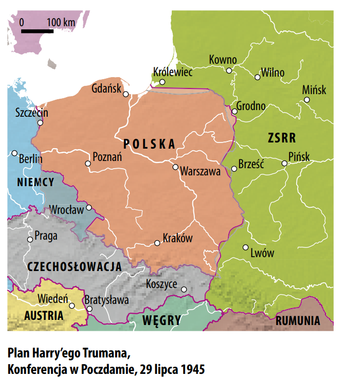
This did not signify a definitive solution. The final communique stated that the final delimitation of Poland’s western border should be postponed until a future peace conference. At the same time, the areas to be placed under Polish administration were defined: among others, the territories east of a line running west of Świnoujście (Swinemünde), and then along the Oder and Lusatian Neisse rivers. Poland thus received the opportunity to exercise authority, but not a formally ratified state border. In a legal sense, this constituted administration, rather than definitive incorporation, though in practice, it was precisely the efficiency of this administration—the resettlement of towns and villages, the launching of seaports and industrial plants—that determined the consolidation of the new order. A powerful argument indicating that no fundamental revision of these decisions was planned was the agreement to the displacement of the German population from the lands granted to Poland.
The completion of Potsdam was achieved through the work of the Polish-Soviet border commission. It regulated the course of the border to the west of the Oder, encompassing the western districts of Szczecin (Stettin), the region of Police (Pölitz), Trzebież (Ziegenort), and Nowe Warpno (Neuwarp), as well as a part of Usedom Island with Świnoujście (Swinemünde). The agreement was signed on 21 September 1945 in Schwerin; on the Soviet side, it was signed on behalf of Marshal Zhukov by Lieutenant General Khabarov, and on the Polish side by Lieutenant Colonel Leonard Borkowicz and Engineer Piotr Zaremba. It entered into force on 4 October 1945.
Pomerania in the Shadow of the Cold War
Potsdam significantly strengthened the Polish position, but it did not close all disputes. Wrocław (Breslau) relatively quickly ceased to arouse major doubts, whereas Szczecin (Stettin), located on the western side of the Oder, remained a special case. Following the conference, Stalin played his own game around the German question. Desiring to win over German society for the communist forces, for over a year he avoided an unequivocal public confirmation of the definitive nature of the Polish western border.
The change occurred following the speech by US Secretary of State James Byrnes in Stuttgart on 6 September 1946. Byrnes accepted the territorial changes in Poland’s favor, but emphasized that their final shape should be confirmed in a peace conference. In response, Vyacheslav Molotov publicly ruled out any revision of the border along the Oder and Lusatian Neisse. However, a treaty that would conclusively regulate the status of the western territories was still missing.
The establishment of the two German states improved Poland’s situation. The GDR, completely dependent on the Soviet Union, was forced to recognize the solutions favorable to Warsaw. On 6 July 1950, the Treaty of Zgorzelec was signed between Poland and the GDR. It did not establish a new border, but rather confirmed the course of the ‘established and existing Polish-German border,’ which indirectly strengthened the significance of the Potsdam decisions.
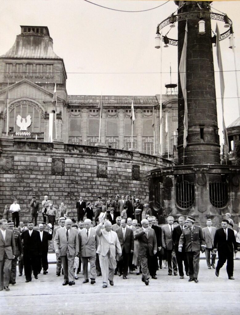
Despite this, the western border remained an element of a broader game among the great powers. Szczecin (Stettin) was a particularly sensitive point, as it did not fit into the simple conception of the Oder as an unambiguous line of demarcation. In the 1950s and 1960s, the Soviet Union played an intensive game surrounding the status of Germany and Berlin. One of its elements was the visit of the First Secretary of the Communist Party of the Soviet Union, Nikita Khrushchev, to Szczecin on 17 July 1959, during which he confirmed Soviet support for the Polish presence in the western and northern territories.
There are fears, however, that the Russians were concurrently considering the possibility of transferring Szczecin (Stettin) to Germany in exchange for a resolution of the German question favorable to them. Polish anxiety was fueled by the position of the Federal Republic of Germany, which for years refused to recognize the border along the Oder and Lusatian Neisse rivers, maintaining in its political doctrine that the German state continued to exist within its 1937 borders. Traces of such thinking could also be found in Western cartographic publications, where the western and northern territories were sometimes depicted as areas of unresolved status.
A breakthrough was brought about only by the new Eastern policy (Ostpolitik) of the FRG. Its significance extended beyond bilateral relations, as it altered the language used in Western Europe to discuss the consequences of the war and post-war borders. The treaty signed in Warsaw on 7 December 1970 by Chancellor Willy Brandt and Prime Minister Józef Cyrankiewicz normalized relations between the states and confirmed the inviolability of the existing border. In doing so, it once again referred to the Potsdam decisions, elevating their international standing. Shortly thereafter, further processes stabilizing the situation followed: in 1972, the Holy See regularized the ecclesiastical administration in the western territories, and contacts between Poland and the GDR, including in the border zone, became more regular.
The Pomeranian Bay: The Last Border Dispute of the PPR
It seemed that the question of Pomerania had been definitively closed. Poland’s cooperation with both the GDR and the FRG developed without major conflicts. However, this did not signify the end of disputes. In the years 1985–1989, a today little-known conflict took place concerning the state border in the Pomeranian Bay. For Poland, this was an issue of immense economic significance. The dispute concerned the areas through which passed the fairway and anchorage essential for the functioning of the Szczecin port. The loss of control over them could have severely restricted the development of the port and the entire maritime economy of the region. On this matter, a broad front in defense of Polish interests formed in Szczecin, transcending political divisions. Voivodeship authorities, local PZPR activists, representatives of ‘Solidarity,’ and the church hierarchy held aligned positions: access to the port and freedom of navigation had to be preserved. The dispute was concluded only by an agreement signed in May 1989. It was an important episode, as it served as a reminder that for Pomerania, the border was not merely a line on a land map. It also encompassed access to the sea, safety of navigation, and the viability of the port, without which Szczecin’s significance as an economic center would be fundamentally limited.
The Unification of Germany and the Definitive Confirmation of the Border
The definitive resolution of doubts was brought about by the turn of the 1980s and 1990s. In the autumn of 1989, FRG Chancellor Helmut Kohl arrived in Poland. A symbolic moment of the visit was the Mass of Reconciliation in Krzyżowa (Kreisau) and the sign of peace exchanged between Kohl and the Polish Prime Minister, Tadeusz Mazowiecki. On the very same day, however, the Berlin Wall fell, initiating the process of German unification.
In Poland, questions quickly arose regarding the consequences of the rebirth of a powerful German state for the border along the Oder and Lusatian Neisse rivers. When, two weeks after the fall of the Wall, Kohl presented his plan for unification, it lacked an unequivocal confirmation of the border with Poland. During press conferences as well, the Chancellor avoided clear declarations. This did not necessarily signify a realistic plan to revise the border, but for the Polish side, it served as a serious warning signal.

Once again, the unity of Polish political forces regarding the border became apparent. In the first half of 1990, Prime Minister Tadeusz Mazowiecki, Foreign Minister Krzysztof Skubiszewski, and President Wojciech Jaruzelski conducted intensive talks in Moscow, London, Paris, and Washington. Their success lay in making the definitive regulation of the Polish-German border a condition for consent to the unification of Germany. Poland, as the only state outside the circle of the two German states and the four occupying powers, was admitted to a portion of the deliberations of the ‘2+4’ conference. It was established there that a unified Germany would encompass the territories of the FRG, the GDR, and Berlin, that it would raise no territorial claims, and that its constitutional order could contain no provisions contradictory to these principles. This was particularly important given the earlier West German doctrine that referred to the 1937 borders.
Consequently, on 14 November 1990, the Polish-German Border Treaty was signed. Following ratification by both parliaments, it entered into force on 16 January 1992. Only from that moment can one speak of a definitive conclusion to the dispute over West Pomerania, Szczecin (Stettin), and the border along the Oder and Lusatian Neisse rivers. This history demonstrates that the Pomeranian border was not a one-off settlement from 1945. It was the result of the war, the decisions of the great powers, Polish diplomatic efforts, resettlement, the work of the administration, and a lengthy process of international recognition of the post-war order.
More:
Akt historyczny: 30 lat traktatu o potwierdzeniu granicy polsko-niemieckiej na Odrze i Nysie Łużyckiej, red. Jan Barcz i Krzysztof Ruchniewicz, Wrocław-Warszawa: Dom Wydawniczy ELIPSA 2021 (https://repozytorium.uni.wroc.pl/dlibra/publication/edition/124957)
Granica na Odrze i Nysie Łużyckiej: zbiór materiałów i dokumentów. T. 1 i 2, oprac. Włodzimierz T. Kowalski, Piotr Lippóczy, Warszawa : Polski Instytut Spraw Międzynarodowych 1971
Marian Orzechowski, Odra – Nysa Łużycka – Bałtyk w polskiej myśli politycznej okresu drugiej wojny światowej, Wrocław: Zakład Narodowy im. Ossolińskich 1969
Adam Makowski